Saturday, Sept. 3 -- Milford, CT
Click on chart thumbnail
for details. Visit
MapTech.com!
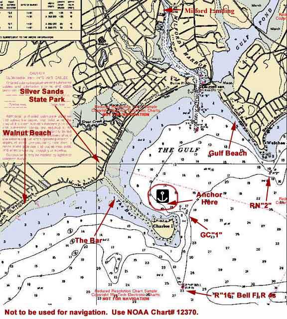
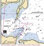
Figure 1. Charles Island, Milford,
CT
Not to be used for navigation. Use NOAA
Chart# 12370, 12364 and 12354.
Fleet communications will be on VHF Ch. 16 and
72.
Plan on meeting in the anchorage north of Charles Island
in The Gulf, in 10-15' of water with a hard sand bottom - softer
near shore. Otherwise we'll be heading up into Milford Harbor
on the Wepawaug River to Milford
Landing (203-874-1610, VHF Ch.
9, dockage $2.50 per foot).
Use tide tables for Bridgeport. High tide at Milford Harbor
is 8 minutes later; low tide is 10 minutes earlier. Mean tidal
range is 6.6 feet.
GC "1" at Charles Island is approximately 5 nm NE
of Stratford point and about 6.5 nm W of the channel entrance
between the New Haven Harbor breakwaters. Be careful of the
shoals to the east and south of Charles Island between R"16"
Bell Fl R 4s and GC "1".
CAUTION: At high tide you may see local boaters
cutting across "The Bar" which connects Charles Island
to Silver Sands State Park on the mainland. DO NOT CROSS
THE BAR. Enter The Gulf between GC "1" (Charles
Island) and RN "2' (Welches Point).
If we're anchored off Charles Island, in the
evening we'll all gather on one of the boats for cocktails.
So bring one or two snack items to share with the rest of the
group in the anchorage and the fixin's for your favorite beverage.
Crews will be on their own for dinner.
If we're tied up at Milford Landing, why not
walk over to the Stonebridge Restaurant for a group dinner?
Milford Landing also has a picnic/barbecue area, so we can still
do a potluck if that's what we decide.
Sunday, Sept. 4 -- Lloyd Harbor, NY -- 28 nm
 Click on chart thumbnail
for details. Visit
MapTech.com!
Click on chart thumbnail
for details. Visit
MapTech.com!
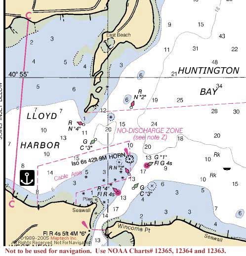
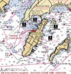
Figures 2. Lloyd Harbor
Not to be used for navigation.
Use NOAA Chart# 12365, 12364 and 12363. It should be a leisurely sail from Milford to our next destination,
Lloyd Harbor, across the Sound in New York.
Huntington Bay, the largest bay on Long Island's north shore,
is the gateway to Northport Bay, Lloyd, Huntington, Centerport
and Northport Harbors. Enter Lloyd Harbor north of Huntington
Lighthouse and stay between GC"3" and RN"4"
to avoid the reefs south of East Beach. Anchor in the small
bight just north of West Neck. Be careful to stay clear of the
cable area.
Use tide tables for Bridgeport. High tide at the Lloyd Harbor
entrance in Huntington Bay is 2 minutes later; low tide is 3
minutes later. Mean tidal range is 7.5 feet.
If the weather prediction is for winds out of the east, we'll
head for Northport instead, and anchor just outside (north)
of the mooring field.
Once everyone's settled, we'll meet aboard one of the boats
again for cocktails and snacks. Everyone's on their own for
dinner.
Monday, Sept. 5 -- City Island, NY -- 22 nm
Click on chart thumbnail
for details. Visit
MapTech.com!
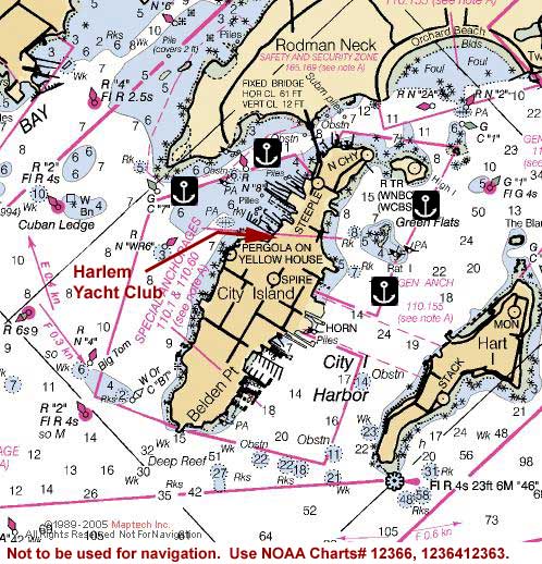
Figure 3. City Island, NY
Not to be used for navigation. Use NOAA
Charts# 12366, 12364 and 12363.
Monday morning we'll cross the Sound once more, this time heading
for City Island and the Harlem Yacht
Club (718-885-1225, VHF Ch. 72).
Located on the western side of the island in the bight defined
by the "PERGOLA ON YELLOW HO" and
the fixed bridge connecting the island to the mainland at Rodman
Neck, you'll find the Harlem
Yacht Club. They have the first docks that you'll
see north of the pergola and their mooring field extends out
towards GC"7" at the southern tip
of Rodman Neck. Hail the yacht club's launch on VHF Ch. 72 or
call in advance for a mooring. If you prefer, you can anchor
anywhere outside the mooring field but you'll find the best
protection between Rodman Neck and the island north of RN"8".
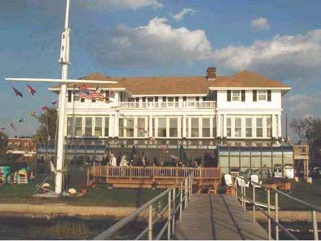
Photo courtesy
of Harlem Yacht Club.
Longitude: 73°47'24 W
Lattitude: 40°51'00 N
Use tide tables for Willets Point. High tide at City Island
is 3 minutes later, low tide is 5 minutes earlier. Mean tidal
range is about 7.5 feet.
Approaching City Island from the South, beware of Big Tom,
a large rock that lies just below the surface, about 500 yards
west of Belden Point. It is well-marked by a triangle of buoys.
Another obstacle to be aware of is Cuban Ledge in the center
of Eastchester Bay.
Once anchored, don't be startled by the sound of gunfire. We'll
be moored within earshot of the police firing range on Rodman
Neck, but don't worry, the shooting will have stopped by the
time you want to hit your bunk.
Since it's Monday and a holiday, the restaurants are likely
to be closed. Let's end the cruise with another onboard get-together.
So bring one or two snack items to share with the rest of the
group in the anchorage/mooring field and the fixin's for your
favorite beverage. Then it's a potluck dinner aboard one of
the boats. No, we don't throw everything into one pot and whatever
comes out is dinner (unless you want to). But whatever you bring
it’s what we'll have.
Fees:
Entry Fee (per boat):
CDSOA Members: FREE
Non-CDSOA Members: $5.00
(pay at the event)
Please
register online by July 20th!
|